
Transport and Infrastructure
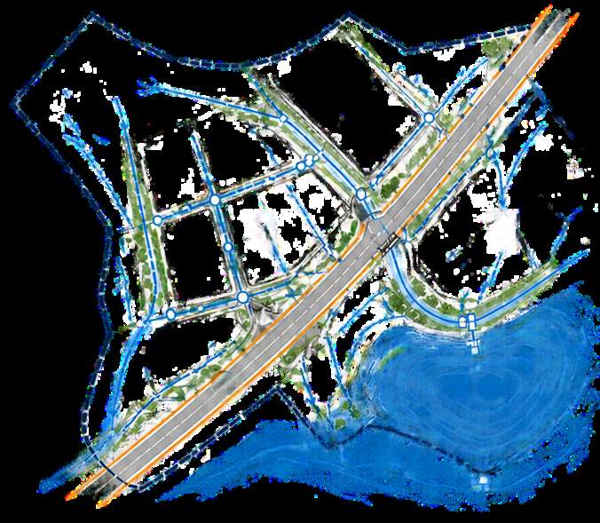
North East Link – M80RRA Flood Modelling Works
Flood Modelling · Hydrology and Hydraulics · Flood Mitigation
Victoria
Client: M80 Ring Road Alliance (Acciona and MACA)
Services
Flood modelling informs drainage design by simulating rainfall, water movement and system performance, to create safe, resilient and maintainable infrastructure.
What we do
With our partner Engeny, we use 12D and Tuflow for drainage assessments and flood modelling, mapping afflux and hazards and verifying mitigation against project requirements.
How we approach it
Flood modelling informs drainage design by simulating rainfall, water movement and system performance, so the infrastructure that follows is safe, resilient and maintainable.
01
Catchment analysis and hydrology and hydraulic assessments establish how water moves across a site before any design is fixed.
02
1D and 2D flood modelling maps afflux and hazard from proposed works, and flood impact and mitigation assessments test the options against project requirements.
03
Drainage networks, swales, culverts, channels and detention basins are designed from the model results, with sedimentation ponds and erosion control for the construction period.
In practice
On North East Link, iterations of flood modelling were run to make sure there was no afflux outside the project boundary.
For temporary works on the M80 Ring Road Alliance, Hyperon built a risk-based flood modelling framework with the Alliance team and MRPV, using 12d and TUFLOW models to map afflux and hazards. Mitigation measures were proposed and verified against project requirements.
Temporary drainage design favoured earthen swales and on-site basins over pits and pipes, and replaced a cess drain with lined channels while keeping pre-development flow conditions.
Standards and tools
Flood modelling in accordance with Melbourne Water standards, applied to the Yando, Kempston and Watsonia catchments across every temporary design stage on North East Link.
12d and TUFLOW, used with Hyperon's partner Engeny, alongside HEC-RAS, DRAINS, RORB and MUSIC from the team's project experience.
In practice
Transport and Infrastructure
Flood Modelling · Hydrology and Hydraulics · Flood Mitigation
Victoria
Client: M80 Ring Road Alliance (Acciona and MACA)

Transport and Infrastructure
Drainage Design · Culvert Design · Temporary Works
Victoria
Client: M80 Ring Road Alliance (Acciona and MACA)

Transport and Infrastructure
Concept Design · Detailed Design · Flood Modelling
Victoria
Client: M80 Ring Road Alliance (Acciona and MACA)