Preparing for Victoria’s 2026–27 Storm Season: Why Early Flood Modelling Saves Infrastructure Budgets
Victoria’s relationship with water has always been complex. A state that spent much of the early 2000s gripped by drought now regularly contends with flooding events that damage roads, overwhelm drainage systems, and blow out infrastructure budgets. For council infrastructure managers, DTP project directors, and contractor project engineers, the question is no longer whether flood risk will affect your next project — it’s whether you’ll be prepared when it does.
Commissioning flood modelling in Victoria before the October–March storm window isn’t just prudent engineering practice. It’s a budget protection strategy that reduces redesign risk, accelerates planning approvals, and ensures your infrastructure performs when it matters most. Here’s why August is the time to act — and what you need to know to get started.
Victoria’s Changing Flood Risk — What the Data Shows
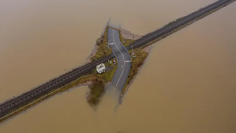
The evidence is difficult to ignore. The October 2022 floods across northern and central Victoria caused more than $5.8 billion in damage, with road and drainage infrastructure bearing a disproportionate share of repair costs. Communities along the Maribyrnong River, Goulburn-Murray catchments, and parts of metropolitan Melbourne experienced inundation that exceeded previous design assumptions. Then in late 2024 and into 2025, successive La Niña-influenced storm seasons again tested infrastructure resilience across regional and outer suburban Victoria.
What’s driving this? Climate change flood modelling in Australia consistently points to two converging trends: higher-intensity short-duration rainfall events in urban catchments, and longer-duration wet periods that saturate rural and peri-urban floodplains. The Bureau of Meteorology’s State of the Climate 2024 report confirmed that short-duration extreme rainfall intensities have increased across south-eastern Australia by approximately 10–15 per cent compared to the baseline period — a shift with direct implications for drainage design and stormwater management in Victoria.
For anyone designing or approving road and drainage infrastructure, the practical consequence is clear. Historical flood records alone no longer provide a reliable basis for design. Updated flood risk assessments and flood modelling grounded in current climate projections and ARR 2019 methodologies are essential to deliver infrastructure that performs across its full design life.
Why August Is the Right Time to Commission Flood Modelling
Timing matters more than most project managers realise. Victorian councils are finalising capital works programs for FY2026–27 right now. Tier 1–3 contractors are scoping drainage components for road projects that will break ground in spring and summer. DTP project teams are locking in design parameters for transport upgrades that need to navigate planning overlays before construction can begin.
Commissioning a flood risk assessment in Melbourne or regional Victoria during August — well ahead of the October–March storm season — delivers three tangible advantages:
Reduced redesign risk. When flood modelling outputs are available early in the design phase, engineers can size culverts, detention basins, and road drainage systems correctly the first time. Retrofitting undersized drainage after detailed design is complete typically adds 15–25 per cent to drainage component costs.
Faster planning approvals. Projects located within a Victorian flood overlay require flood studies as part of the planning permit application. Submitting modelling outputs that align with Melbourne Water’s current guidelines and ARR 2019 avoids the back-and-forth review cycles that delay approvals by months.
Budget certainty. Flood modelling completed before tender documentation is finalised means contractors can price drainage works accurately, reducing the contingency padding that inflates bids — or worse, the variation claims that surface mid-construction when unforeseen flood risks emerge.
Effective design management at this stage can also help ensure flood modelling outputs are integrated with other engineering disciplines before detailed designs are finalised.
In short, every week you delay commissioning flood modelling through winter is a week less buffer you have before storm season exposes gaps in your project’s flood resilience.
Key Modelling Approaches for Road and Drainage Infrastructure
Not all flood modelling is created equal. The appropriate methodology depends on the catchment characteristics, the infrastructure type, and the regulatory requirements governing the project. For road and drainage projects across Victoria, two approaches dominate.
TUFLOW
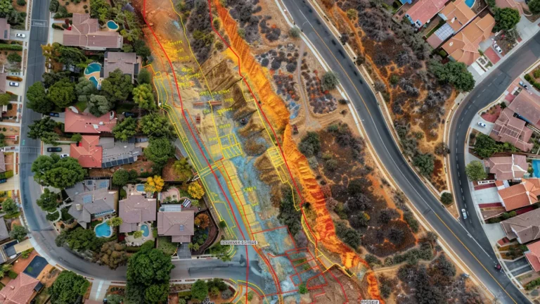
TUFLOW is the industry-standard two-dimensional hydrodynamic modelling software used extensively for floodplain mapping, drainage design, and stormwater management in Victoria. It simulates how water moves across the landscape — through streets, overland flow paths, waterways, and pipe networks — providing detailed flood extent, depth, velocity, and hazard mapping.
For road projects, TUFLOW modelling is essential for assessing overtopping risk at creek crossings, sizing longitudinal drainage, and confirming that road pavements remain trafficable during design storm events.
RORB
RORB is a hydrological modelling tool widely used across Australia for rainfall-runoff estimation. It calculates peak flows and runoff volumes from catchments, which then feed into hydraulic models like TUFLOW or inform the design of retardation basins and outfall structures. Melbourne Water frequently requires RORB-based hydrology as part of its development approvals process.
For many transport and civil infrastructure projects, the most robust approach combines both: RORB to generate catchment hydrology and TUFLOW to simulate detailed flood behaviour at the project site. This integrated modelling framework aligns with ARR 2019 best practice and satisfies the requirements of most referral authorities across Victoria.
Hyperon’s flood modelling services include flood impact assessments, hydrology and hydraulic assessments, flood mitigation assessments, 1D and 2D flood modelling, and assessment and design of hydraulic structures.
Choosing a flood modelling consultant in Melbourne with demonstrated experience across both platforms — and familiarity with the specific requirements of Melbourne Water, council referral processes, and DTP standards — ensures your modelling outputs are fit for purpose and accepted first time.
How Early Flood Analysis Reduces Project Cost Blowouts
Consider a scenario familiar to many project engineers: a council-funded road upgrade in Melbourne’s growth corridors. The project includes 2.4 kilometres of arterial road widening, new intersections, and associated drainage works. The preliminary design assumes existing Council drainage capacity is adequate, with minor augmentation.
Six months into detailed design — now November, with earthworks scheduled for January — the contractor’s drainage designer identifies that the upstream catchment has been significantly developed since the original drainage scheme was built. Updated flood modelling reveals that the 1% AEP (Annual Exceedance Probability) flow is 35 per cent higher than the pipe network was designed to convey. The road’s longitudinal drainage needs to be upsized, a new retardation basin is required, and the road profile at a low point needs to be raised by 400 millimetres to maintain freeboard.
The result? A $1.2 million variation on a $9 million project, a 14-week program extension that pushes roadworks into the wet season, and a strained relationship between the contractor, council, and design consultant.
Had flood modelling been commissioned in August as part of the concept design phase, the updated flows would have been identified before the road geometry was set. The detention basin would have been incorporated into the land acquisition process. The drainage design would have been right-sized from the start. Total additional cost at concept stage: approximately $35,000 for the modelling study, versus $1.2 million in rework.
This is where integrating flood analysis with civil engineering design becomes particularly important. Flood and drainage requirements can be coordinated with road geometry, earthworks, utilities and other infrastructure elements early in the design process.
This is not a hypothetical edge case. It reflects a pattern we see repeatedly across drainage design for storm season projects, particularly in Melbourne’s western and south-eastern growth areas where catchment conditions are changing rapidly.
Regulatory Requirements — Melbourne Water, Council Overlays and ARR 2019
Understanding the regulatory landscape is critical to scoping flood modelling correctly and avoiding costly compliance gaps.
Melbourne Water
Melbourne Water is the floodplain management authority for most of metropolitan Melbourne and requires flood studies for developments within designated flood-prone areas. Their guidelines specify modelling standards, climate change allowances, and freeboard requirements that must be addressed in any flood risk assessment for Melbourne projects.
Victorian Flood Overlay (LSIO/SBO/FO)
Victorian flood overlay (LSIO/SBO/FO) provisions in local planning schemes trigger mandatory referral to floodplain management authorities for works within identified flood-prone land. Projects within these overlays cannot proceed to a planning permit without a compliant flood study.
Council infrastructure teams and contractors working within overlay areas need to factor modelling lead times into their project programs — a process that ideally begins months before a permit application is lodged.
Australian Rainfall and Runoff 2019 (ARR 2019)
Australian Rainfall and Runoff 2019 (ARR 2019) represents the national standard for flood estimation in Australia. It introduced significant changes from the previous 1987 edition, including revised intensity-frequency-duration (IFD) data, ensemble temporal patterns, new areal reduction factors, and explicit guidance on climate change considerations.
Any flood modelling undertaken in Victoria today must comply with ARR 2019 to be accepted by referral authorities. If your project relies on modelling prepared under the old ARR 1987 framework, it will almost certainly require updating.
For projects involving climate change flood modelling in Australia, ARR 2019 and Melbourne Water both recommend applying a rainfall intensity increase factor — typically 16–32 per cent depending on the planning horizon — to account for projected changes in extreme rainfall. This directly affects pipe sizing, detention volumes, and overland flow path design for transport infrastructure.
Checklist — What to Provide Your Flood Modelling Consultant
To ensure your flood modelling engagement runs efficiently, prepare the following information before your initial scoping meeting:
- Site survey and topographic data — LiDAR, feature survey, or detailed contour information for the project area and upstream/downstream catchment.
- Existing drainage plans — Council or Melbourne Water as-constructed plans for pit and pipe networks, open channels, and waterway crossings within and adjacent to the project area.
- Planning overlay information — Confirmation of whether the site falls within an LSIO, SBO, or FO under the relevant planning scheme.
- Previous flood studies — Any existing modelling reports for the catchment, even if outdated, as they provide a useful baseline.
- Development context — Details of upstream land use changes, approved but unbuilt subdivisions, or future development plans that may alter catchment runoff.
- Design criteria — The target AEP for the drainage system (e.g., 10% AEP for minor system, 1% AEP for major system) and any client- or authority-specific requirements.
- Project program — Key milestones including planning application lodgement dates, detailed design completion, and construction commencement.
Providing this information upfront allows your consultant to accurately scope the modelling, identify data gaps early, and deliver results aligned with your project timeline.
Next Steps — Get Ahead of the Storm Season
Victoria’s storm season doesn’t wait for project programs to catch up. The infrastructure managers, project directors, and contractor engineers who commission flood modelling now — during winter, when there’s still time to integrate results into design and approvals processes — are the ones who deliver projects on budget and on time.
Whether you’re scoping drainage design for a road upgrade, assessing flood risk for a new intersection, or updating legacy modelling to comply with ARR 2019 and current Melbourne Water requirements, early engagement with an experienced flood modelling consultant makes a measurable difference to project outcomes.
Hyperon Engineering’s flood modelling team works across TUFLOW and RORB for government and private-sector clients delivering road, transport, and drainage projects throughout Victoria. We understand the regulatory requirements, the catchment conditions, and the practical realities of integrating flood modelling into civil and transport infrastructure design.
Book a free initial consultation with our flood modelling team to scope your project before storm season. Let’s make sure your next infrastructure project is designed for the conditions Victoria is actually experiencing — not the ones we used to plan for.