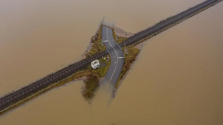
Every winter, Melbourne’s storm season tests the resilience of our drainage networks, floodplains and built environments. With the Bureau of Meteorology flagging wetter-than-average conditions for south-eastern Australia through winter and spring 2026, the question for council infrastructure managers and land developers isn’t whether flooding will affect their projects — it’s whether they’ll be prepared when it does.
If you’ve been considering a flood study in Melbourne but haven’t yet pulled the trigger, now is the time. Commissioning a flood risk assessment before peak storm season hits gives you the data, the models and the regulatory approvals you need to protect assets, avoid costly redesigns and keep projects moving through the planning pipeline.
In this guide, we break down what’s driving flood risk this season, when a flood study is required, what the process involves, and how proactive modelling saves time and money for councils and developers alike.
Melbourne’s 2026 Storm Season — What Infrastructure Managers Need to Know
Melbourne’s climate has always delivered unpredictable winters, but the data trend is clear: intense, short-duration rainfall events are becoming more frequent, and catchment responses are changing as urban infill increases impervious surfaces across the metropolitan area.
The 2026 outlook reinforces the need for vigilance. Climate modelling from the Bureau of Meteorology and CSIRO points to above-average rainfall across Victoria through August and September, driven by a combination of La Niña-influenced sea surface temperatures and a negative Indian Ocean Dipole. For infrastructure managers and developers, this translates to elevated flood risk across established and greenfield catchments alike.
Recent seasons have already demonstrated the consequences. Flash flooding in Melbourne’s south-east and western growth corridors has caused road closures, property damage and significant delays to construction programs. Councils are fielding increasing numbers of planning referrals that require Melbourne stormwater management assessments, and Melbourne Water is tightening its expectations around flood modelling accuracy and reporting standards.
The takeaway is straightforward: if your project sits within or near a flood-prone area — or if you suspect drainage capacity may be inadequate — a winter storm drainage review in Melbourne should be high on your priority list before conditions deteriorate further.
When Is a Flood Study Required? Key Triggers for Councils and Developers
Understanding when a flood study is required can save weeks of back-and-forth with referral authorities. In Victoria, several common triggers apply to both council-led infrastructure projects and private development applications.
Melbourne Water referrals and flood overlays. If land is affected by a Land Subject to Inundation Overlay (LSIO) or Special Building Overlay (SBO) in the local planning scheme, any planning permit application will typically be referred to Melbourne Water. A council flood overlay report — often including detailed hydraulic modelling — is a standard requirement before Melbourne Water will provide conditions or consent. Without this report, your application stalls.
New developments in established catchments. Infill development, subdivision and medium-density housing in established suburbs frequently increase impervious area and alter overland flow paths. Councils and Melbourne Water may require a flood risk assessment in Victoria to demonstrate that the proposed development does not worsen flood conditions for neighbouring properties or downstream infrastructure.
Drainage upgrade and renewal programs. Councils planning capital works on ageing stormwater networks need current flood data to prioritise investment. A flood study in Melbourne quantifies existing capacity, identifies pinch points and models the impact of proposed upgrades under a range of storm scenarios — from the 1-in-5-year event through to the 1% Annual Exceedance Probability (AEP) and climate change allowances.
Greenfield and growth area development. Precinct Structure Plans (PSPs) and Development Services Schemes (DSSs) in Melbourne’s growth corridors require flood modelling to establish development levels, retardation basin sizing and drainage corridor reservations.
Post-event investigations. Following significant flood events, councils and asset owners may commission flood studies to understand what happened, calibrate models against observed data and identify mitigation measures to reduce future risk.
If any of these triggers apply to your current or upcoming projects, early engagement with a flood modelling consultant ensures you have the evidence base to satisfy referral authorities and inform sound engineering decisions.
What a Flood Study Involves — Process, Models and Deliverables
A flood study is more than a desktop exercise. It’s a rigorous, multi-stage engineering investigation that combines field data, computational modelling and expert interpretation to quantify flood behaviour across a catchment or development site.
Here’s what the typical process looks like:
1. Data Collection and Review
The study begins with gathering existing information — survey data, LiDAR terrain models, drainage asset records, historical flood data, aerial imagery and relevant planning scheme overlays. Site inspections confirm ground conditions, identify flow paths and verify asset details that may not appear in council records.
2. Hydrological Modelling
Rainfall-runoff models (commonly RORB, WBNM or similar platforms accepted by Melbourne Water) are built to simulate how rainfall translates into flow across the catchment. Design storms are generated from the latest Australian Rainfall and Runoff (ARR 2019) guidelines, including ensemble temporal patterns and climate change adjustments as required by Melbourne Water’s Land Development Manual.
3. Hydraulic Modelling
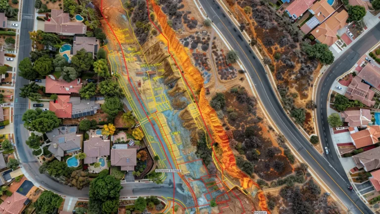
Two-dimensional (2D) hydraulic models — typically TUFLOW or similar — simulate how floodwater moves across the landscape and through the drainage network. These models produce flood extent maps, depth grids, velocity outputs and hazard categorisations that form the foundation of any flood risk assessment in Victoria.
4. Scenario Analysis
Models are run for a range of design events (e.g. 10% AEP, 5% AEP, 1% AEP) and may include sensitivity testing for blockage, climate change and development scenarios. This analysis allows councils and developers to understand not just current conditions but future risk under a changing climate and evolving land use.
5. Reporting and Deliverables
The final flood study report presents methodology, results, flood mapping and recommendations in a format suitable for submission to Melbourne Water, council planning departments or internal asset management teams. Deliverables typically include GIS-compatible flood layers, a written report, and supporting model files.
For Melbourne stormwater management applications, the study may also include assessment of water quality treatment, retardation storage and outfall adequacy to satisfy Clause 56 (residential subdivision) or Clause 53.18 (stormwater management) requirements.
How Proactive Flood Modelling Reduces Project Risk and Cost
One of the most common — and most expensive — mistakes we see is flood modelling being treated as an afterthought. When a flood study is commissioned late in the design process, or only after a referral authority requests one, the results frequently force design changes that could have been avoided with earlier investigation.
Avoiding redesign and rework. A flood study completed during the concept or preliminary design phase identifies constraints — minimum floor levels, overland flow paths, required pipe capacities — before detailed design is locked in. Redesigning a subdivision layout or road profile to accommodate flood levels discovered at the eleventh hour can add weeks of delay and tens of thousands of dollars in additional engineering fees, not to mention resubmission costs.
Accelerating planning approvals. Melbourne Water and council planning departments assess applications more quickly when the flood modelling is thorough, current and compliant with the latest guidelines. Incomplete or outdated flood studies trigger requests for further information (RFIs), which can delay permit approvals by months. A robust, well-documented flood study submitted with the initial application significantly reduces the risk of RFIs and objections.
Supporting grant and funding applications. For councils seeking state or federal funding for drainage upgrades or flood mitigation works, a current flood study provides the quantified evidence needed to demonstrate benefit-cost ratios and prioritise investment. Without this data, business cases lack the rigour that funding bodies expect.
Managing liability. Infrastructure managers and developers have a duty of care to consider flood risk. A professional flood risk assessment in Victoria, undertaken by a qualified consultant and consistent with accepted industry guidelines, provides a defensible evidence base that demonstrates due diligence in managing flood-related risks.
In short, commissioning a flood study early doesn’t add cost — it prevents it.
Checklist — Preparing for a Flood Study Engagement
If you’re ready to commission a flood study in Melbourne, having the right information on hand will help your consultant scope the project efficiently and deliver results faster. Use this checklist to prepare:
- Site survey data — recent feature and level surveys of the study area, including pipe inverts and drainage structures where available.
- LiDAR or terrain data — check whether current LiDAR coverage is available through your council GIS or the Victorian Government’s Spatial Datamart.
- Drainage asset information — council or authority drainage plans, CCTV inspection reports, pipe and pit schedules.
- Planning scheme overlays — identify whether the site is affected by LSIO, SBO or other flood-related overlays.
- Historical flood records — any documented flood events, photographs, community complaints or gauged flow data relevant to the catchment.
- Development plans — if the study supports a planning application, provide the proposed site layout, lot plan and civil engineering drawings (even in draft form).
- Melbourne Water pre-application advice — if you’ve already engaged with Melbourne Water, share any correspondence or conditions they’ve flagged.
- Project timeline — confirm key milestones such as planning lodgement dates, council meeting schedules or construction program deadlines so modelling can be sequenced accordingly.
Having these items ready at project kick-off avoids delays during the data collection phase and ensures your flood modelling consultant can hit the ground running.
How Hyperon Engineering Can Help
At Hyperon Engineering, we deliver flood studies and stormwater management assessments for councils, developers and infrastructure delivery teams across Melbourne and regional Victoria. Our team combines deep expertise in hydrological and hydraulic modelling with practical civil and transport engineering experience — which means our flood studies don’t just satisfy referral authorities; they integrate seamlessly with road design, drainage design and infrastructure delivery programs.
Whether you need a council flood overlay report for a planning application, a catchment-wide winter storm drainage review for Melbourne’s growth corridors, or a detailed flood risk assessment in Victoria to support a major infrastructure project, we have the capability and the local knowledge to deliver.
Our flood modelling services include:
- Hydrological modelling (RORB, WBNM) in accordance with ARR 2019
- 2D hydraulic modelling (TUFLOW) for flood mapping and hazard assessment
- Melbourne Water referral and planning submission support
- Climate change and development scenario analysis
- Integration with civil and transport infrastructure design
With storm season upon us, there’s no better time to get ahead of the risk. Download our flood study preparation checklist to start gathering the information you need, or contact Hyperon Engineering to discuss scoping your next flood study. Reach out to our team at soumendra.paul@hyperon.com.au — we’re ready to help you plan with confidence before the next storm hits.