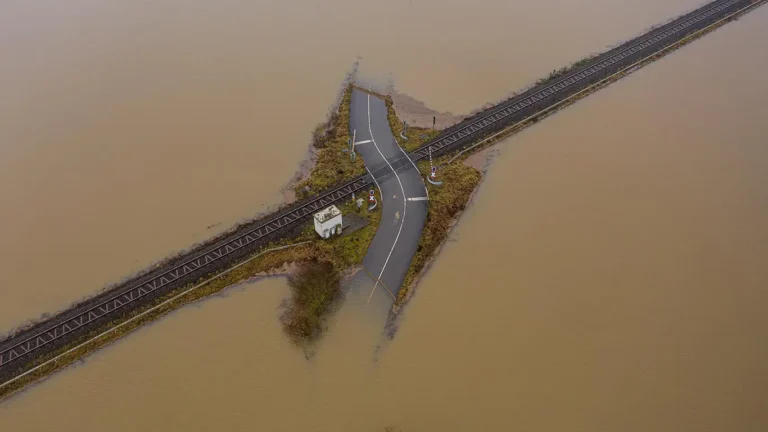
Every year, Melbourne’s storm season catches someone off guard. Overland flow paths overwhelm ageing drainage infrastructure. Development sites stall because flood overlay planning permits weren’t lodged early enough. Capital works budgets blow out when emergency responses replace planned interventions. For council stormwater engineers and developer project managers, Melbourne flood season preparation isn’t something that should start in October — it needs to start now, in August, while there’s still time to commission modelling, interpret results, and act on findings before the first major rainfall event.
This post explains what the data is telling us about flood risk in Melbourne heading into 2026, when Victorian regulations require a flood study, and why getting a model underway today — rather than after the floodwaters recede — is the single most effective step councils and developers can take to reduce project risk.
Melbourne’s Flood Risk Profile — What the Data Shows
Melbourne’s wettest quarter historically falls between October and December, with the Bureau of Meteorology (BOM) consistently recording the highest monthly rainfall totals and the greatest frequency of intense short-duration storms during this window. For the 2026 season, BOM’s seasonal climate outlook bears close attention. Indian Ocean Dipole (IOD) phases and La Niña patterns have driven above-average rainfall across south-eastern Australia in recent years, and long-range forecasts suggest that elevated soil moisture and warmer sea-surface temperatures could again increase flood risk across Melbourne’s sprawling urban catchments.
The numbers reinforce the urgency. Between 2010 and 2024, Melbourne Water recorded a marked increase in flood-related insurance claims across the northern and western growth corridors — areas where impervious surfaces are expanding faster than drainage infrastructure can keep pace. Council flood study requirements in Victoria have tightened in parallel, with Melbourne Water and the relevant floodplain management authorities expecting more rigorous, data-driven assessments before approving drainage strategies or signing off on planning referrals.
For anyone involved in stormwater management in Melbourne — whether you’re a council engineer prioritising FY26-27 drainage capital works or a developer seeking a flood overlay planning permit — understanding this risk profile is not optional. It’s the foundation on which every downstream decision rests.
Regulatory Triggers — When Victorian Councils and Developers Must Commission a Flood Study
Not every project requires a flood model, but a surprising number do — and the triggers are often misunderstood until they cause delays at the planning permit stage.
Under Victorian planning schemes, land identified within a Land Subject to Inundation Overlay (LSIO) or Special Building Overlay (SBO) will almost always require a flood study as part of any planning permit application. Melbourne Water, as the relevant floodplain management authority for most of Greater Melbourne, acts as a referral authority for applications on flood-affected land. Their guidelines are explicit: applicants must demonstrate, through ARR 2019 flood modelling or equivalent, that the proposed development will not increase flood risk to neighbouring properties, will provide adequate freeboard to habitable floor levels, and will manage stormwater in a manner consistent with best-practice floodplain management.
Council flood study requirements in Victoria extend beyond the planning permit process. Under the Water Act 1989 and the Victorian Floodplain Management Strategy, councils have a direct responsibility to understand and communicate flood risk within their municipalities. This means commissioning municipal flood studies, updating outdated models that predate the Australian Rainfall and Runoff (ARR) 2019 guidelines, and ensuring that drainage infrastructure strategies are founded on current hydrology and hydraulic modelling.
Key regulatory triggers that should prompt a flood study include:
- Planning permit applications on land within an LSIO, SBO, or Floodway Overlay — Melbourne Water will require a flood assessment as part of the referral.
- Subdivision of land in flood-prone areas — even where overlays are not yet mapped, Melbourne Water may request modelling if historical flood data suggests risk.
- Council drainage capital works programs — upgrades to retarding basins, culverts, or open channel systems should be designed against current ARR 2019 design flows, not outdated IFD data.
- Development contributions plan (DCP) infrastructure — growth area councils must justify drainage infrastructure sizing through robust modelling to support DCP levy calculations.
- Climate change adaptation planning — the Victorian Planning Authority and many councils now require climate change sensitivity analysis as part of precinct structure plans.
If any of these triggers apply to your current or upcoming projects, the time to commission modelling is well before storm season — not during it.
Benefits of Early Flood Modelling Before Storm Season
Commissioning a flood model in August or September, ahead of Melbourne’s storm season, delivers tangible benefits that compound across the project lifecycle.
Reduced approval risk. Melbourne Water’s referral response times can extend to several weeks, and incomplete or non-compliant flood assessments are the single most common reason for requests for further information (RFIs). A model completed before October allows time for peer review, iteration if required, and submission well ahead of the storm season rush, when both consultancies and referral authorities experience peak workloads.
Better-informed capital works prioritisation. For council engineers preparing FY26-27 drainage budgets, a current flood model provides the evidence base to rank competing projects by risk reduction benefit. Without it, investment decisions are based on anecdotal knowledge or outdated studies — neither of which withstands scrutiny during budget approval or audit processes.
Calibration opportunity. A model built before the storm season can be calibrated or validated against observed flood behaviour during the season itself. This is an enormous advantage. Post-event flood level surveys, resident reports, and gauge data collected during real storms can be compared against model predictions, strengthening confidence in the model’s outputs and supporting future design decisions.
Cost certainty for developers. On development sites, late-stage flood modelling frequently reveals constraints that require design changes — increased floor levels, additional retarding basin storage, or reconfigured lot layouts. Discovering these constraints in August, not January, keeps construction programs on track and avoids costly rework.
Alignment with ARR 2019 best practice. The ARR 2019 guidelines introduced significant changes to design rainfall estimation, temporal patterns, and ensemble modelling approaches. Models built under superseded methods may no longer satisfy Melbourne Water’s requirements. Early engagement with a flood modelling consultant ensures the methodology aligns with current standards from the outset, eliminating the risk of a rejected submission.
Key Steps to Commissioning a Flood Study — Checklist for Council Engineers and Developer PMs
Preparing to commission a flood study doesn’t need to be complex, but following a structured approach ensures the scope is right, the data is available, and the timeline is achievable before storm season. Here is a practical checklist:
1. Define the Study Purpose and Required Outcomes
Is the model supporting a planning permit application, a drainage strategy, a capital works business case, or a municipal flood study update? The purpose determines the modelling approach, level of detail, and reporting format.
2. Gather Existing Data
Collate any previous flood studies, survey data, drainage asset information (pit and pipe networks, culvert dimensions, channel cross-sections), LiDAR or photogrammetry datasets, and Melbourne Water flood level data for the catchment. The more data available at the outset, the more efficient the modelling process.
3. Confirm the Regulatory Context
Identify relevant overlays (LSIO, SBO, Floodway), determine whether Melbourne Water is a referral authority, and clarify any specific council requirements. Some councils have preferred modelling software or reporting templates.
4. Engage a Specialist Flood Modelling Consultant
Look for experience with ARR 2019 flood modelling, local catchment knowledge, and established relationships with Melbourne Water and council floodplain teams. A consultant who understands both the technical modelling and the regulatory pathway will deliver a more efficient, lower-risk outcome.
5. Allow Adequate Time for Peer Review and Iteration
Budget at least two to three weeks beyond model completion for internal review, client review, and any revisions before submission to the relevant authority.
6. Plan for Post-Storm Calibration
If the model will be completed before storm season, discuss with your consultant how observed flood data can be used to validate model performance — this adds significant value to the study at minimal additional cost.
How Hyperon Engineering Supports Councils and Developers
Hyperon Engineering is a Melbourne-based civil and transport engineering consultancy with deep expertise in flood modelling, stormwater management, and drainage infrastructure design. Our team delivers flood studies that satisfy Melbourne Water referral requirements, support council drainage capital works programs, and provide developers with the certainty they need to progress planning permits and construction programs without delay.
We work with ARR 2019 compliant methodologies across industry-standard hydraulic and hydrologic modelling platforms, tailoring every study to the specific catchment conditions, regulatory requirements, and project objectives of our clients. From initial scoping through to final reporting and authority liaison, Hyperon’s approach is collaborative, technically rigorous, and grounded in practical project delivery experience.
Our flood modelling services integrate seamlessly with our broader civil engineering, road design, and stormwater management capabilities — meaning that when a flood model identifies a constraint, we can immediately translate that into a design solution, whether it’s a retarding basin, upgraded culvert, or reconfigured road drainage network.
For councils updating municipal flood studies or developers navigating flood overlay planning permit requirements, Hyperon provides the specialist capability and local knowledge that makes the difference between a smooth approval process and months of costly delays.
Act in August, Not After the Floods
Melbourne flood season preparation is not a reactive exercise. The councils and developers who commission flood modelling now — in August, before the historically wettest quarter — are the ones who enter storm season with clear risk profiles, compliant submissions lodged with Melbourne Water, and capital works programs underpinned by current, defensible data.
Waiting until after the floods arrive means competing for consultancy availability during peak demand, facing extended referral authority response times, and making decisions under pressure with incomplete information. The cost of delay is measured not just in dollars, but in project risk, approval timelines, and community safety outcomes.
Whether you need a municipal flood study update, a site-specific flood assessment for a planning permit, or ARR 2019 compliant modelling to support a drainage infrastructure business case, the right time to start is now.
Contact Hyperon Engineering to schedule a flood modelling scoping session before the 2026 storm season. Reach out to our team today and ensure your projects are prepared, compliant, and resilient — before the rain arrives.